About Us
1984
The Beginnings
The company specialized in the implementation and execution of all surveying services in connection with modern GPS technology.
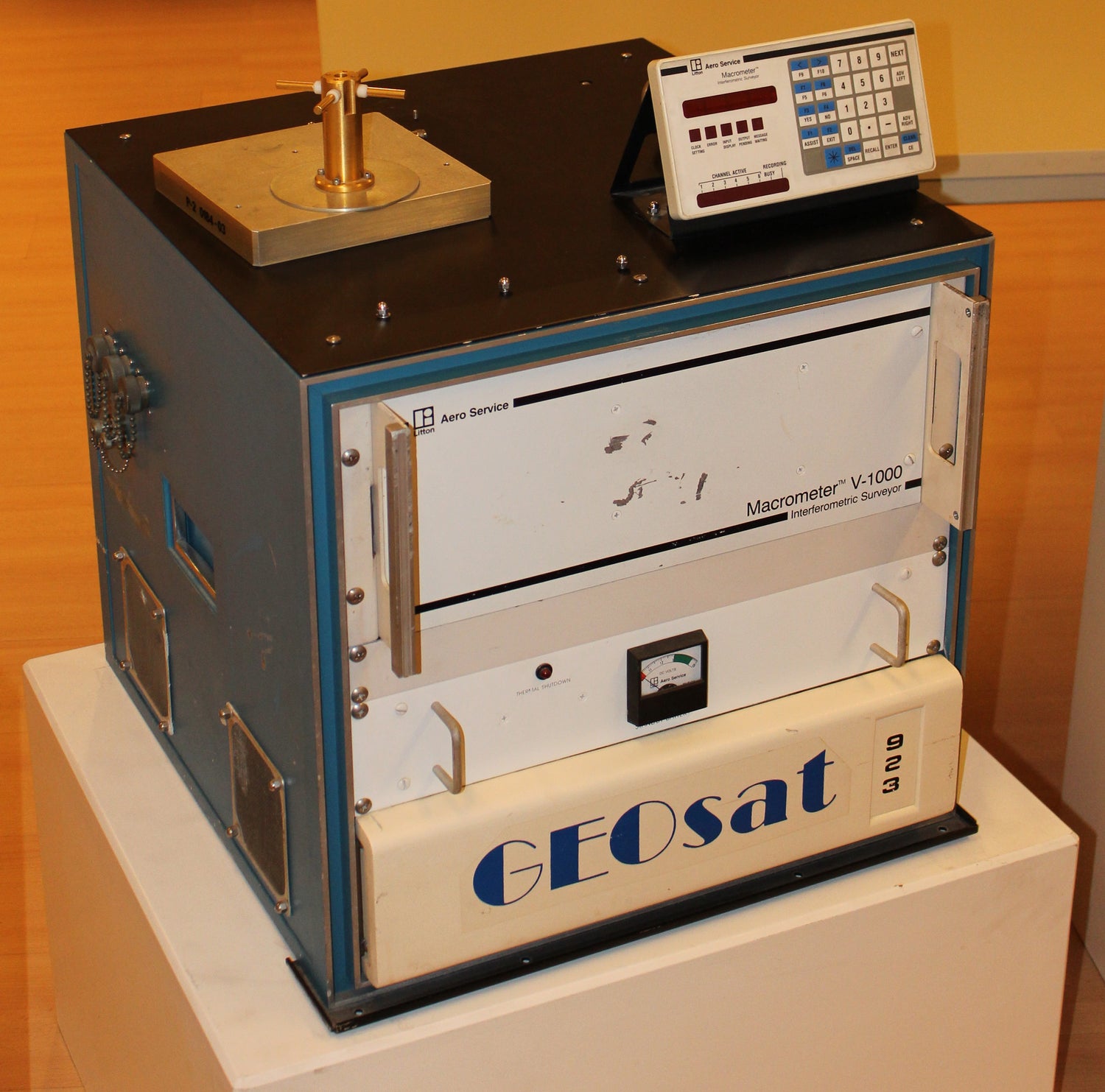
The first four commercially built GPS devices, the Macrometer V-1000, were the basis for introducing GPS in Europe in 1985.
The first receivers can now be viewed in the company museum and various other museums such as the Deutsches Museum in Munich.
1980s
state surveying
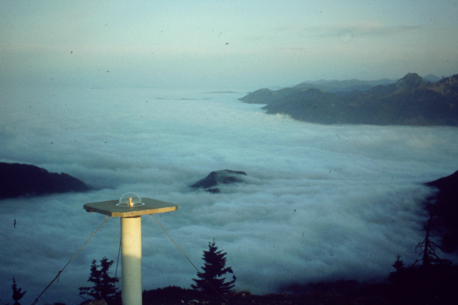
GEOsat was involved in the establishment and determination of numerous control point fields for national surveying and various engineering geodetic works at home and abroad. Examples include the new observation of the trigonometric control point field in North Rhine-Westphalia, a network of over 1,000 control points in Saxony-Anhalt, the monitoring network of the German Electron Synchrotron (DESY) in Hamburg, deformation analyses of offshore platforms in the Adriatic and in the Ekofisk (North Sea) and others.
The company was involved in the definition, installation and calculation of a new precise GPS base network over the entire territory of the Federal Republic of Germany (DREF). Today the company is in demand for consulting services,
for the development of national networks and the introduction of GNSS technology in land surveying in the countries of Southern and Eastern Europe.
1989
vehicle navigation
Based on the existing expert knowledge, GEOsat was integrated into
Research projects of the European Union with the aim of making comprehensive use of GPS technology. GEOsat was also commissioned to examine GPS receivers from Honeywell ELAC with regard to
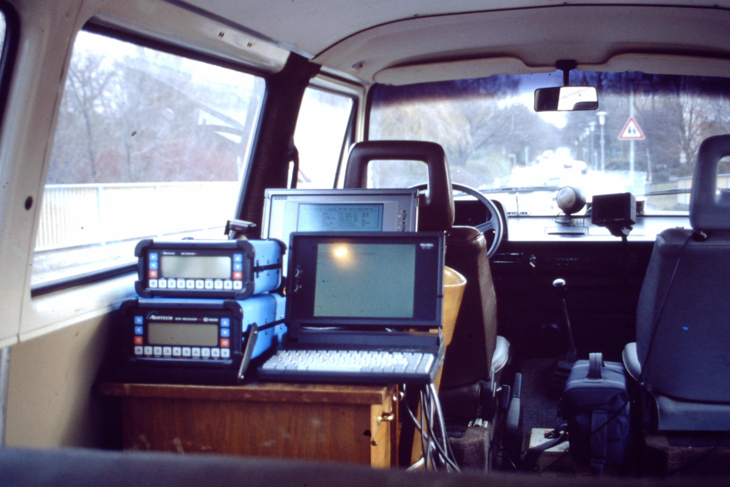
their suitability for geodetic tasks. In an independent continuation of the PROMETHEUS research project (end of the 1980s), the vehicle navigation system GEOfan was developed. This technology made it possible to record the geometry of the streets and geocode the street inventory with the help of additional video camera systems. At a time when "navigation systems" and mobile mapping were not yet conceivable.
1990s
In-house device development
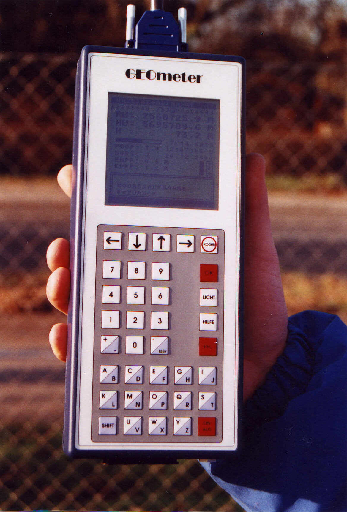
A significant step in the company's history is the development of an independent DGPS field recording system - the GEOmeter. The first prototype was presented in 1996. Against the background of the increasing use of geographical information systems, the GEOmeter offers the user the possibility of recording structures/geometries and factual data quickly, efficiently and precisely. The areas of application of the GEOmeter extend across the entire economy. In agriculture, the device is used for area recording in connection with the EU's subsidy policy, in forestry, damaged areas are measured, in gravel pits the mining progress is documented, environmental analyses are geocoded, in
The digital and analogue data sets are continued by the national survey.
2000s
Abu Dhabi branch
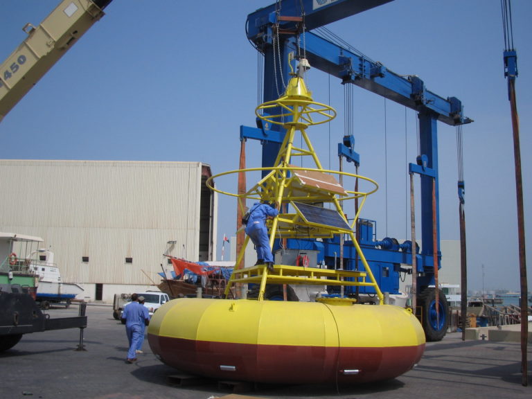
The GEOsat Communication Systems branch GEOsat Middle East, founded in 2006 in the prosperous United Arab Emirates, aimed to market the company’s know-how in the booming Middle East region.
The focus of the activities was on various engineering services for GNSS tracking solutions and on the planning and installation of video and radar surveillance systems. The commitment was discontinued in 2013 after the successful installation and commissioning of various systems.
Track and Trace
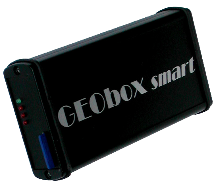
GEObox system
With the introduction of the GEObox family in 2005, GEOsat opened up the logistics and telemetry market. The focus here is on creating added value through the customer-specific integration of location, time and sensor information with that of performance accounting. The interdisciplinary approach of GMES, geoinformation and satellite navigation with the integration of Galileo supports the integration of GNSS sensors into any process and logistics cycle.
Research and Development

research projects
In recent years, various industrial development and
research projects implemented.
Below is a list of recent and current development projects or joint projects